Sunday, November 11, 2018

A Smokey Day on Skyline Ridge Open Space Preserve

Skyline Ridge Open Space Preserve has a lot going for it. Two beautiful ponds, an archaeological site, ecological diversity, and best of all, spectacular views into the Pescadero Creek watershed and on to the Pacific coast. Unfortunately, due to smoke from the Camp Fire in Butte County, the views weren't all that great yesterday.

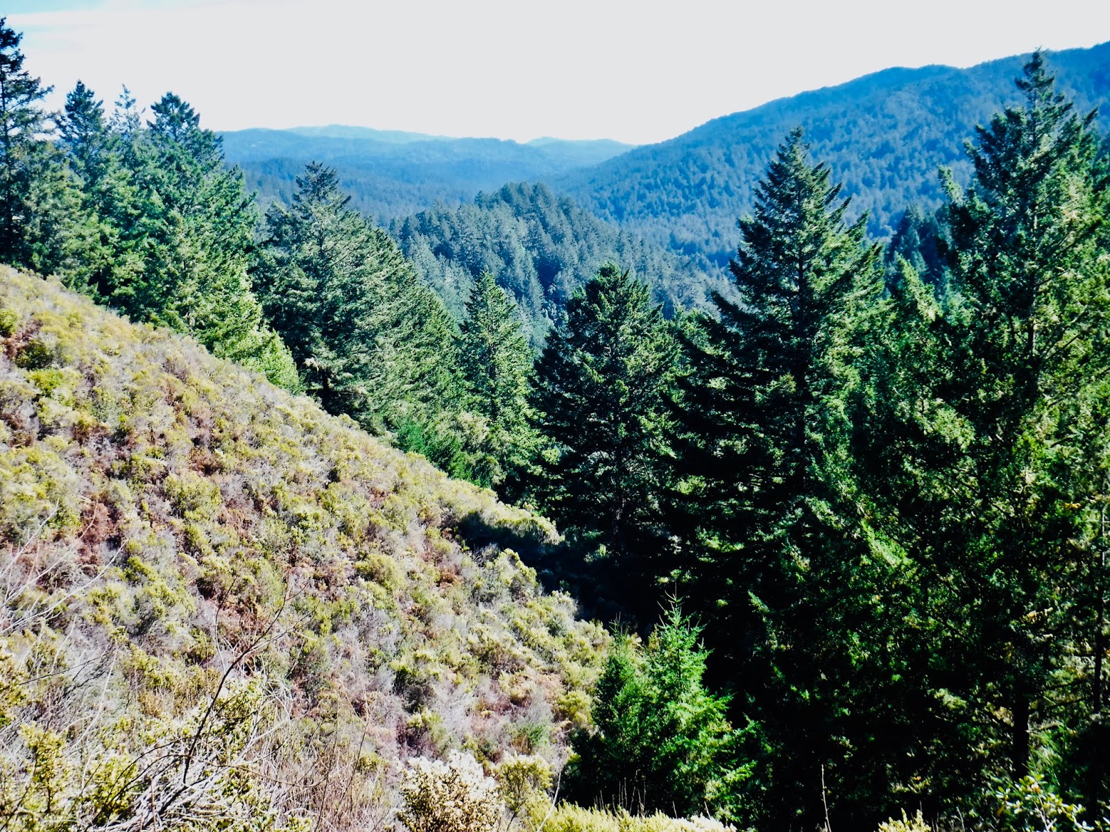
Starting at the main parking lot, my De Anza College class hiked uphill to the trail junction. We then proceeded straight ahead on the Ridge Trail to a northward turn where low growing chaparral would have given way to spectacular views had the scenery not been obscured by smoke. This trail passes magnificent canyon live oaks and California fuchsias sporting red trumpet-shaped flowers. We then headed downhill on a dirt road below the earthen dam to view one of the best archaeological sites in the Santa Cruz Mountains: dozens of holes made in a sandstone rock by Ohlone women centuries ago as they pounded acorns into flour.  We then circled around Alpine Pond, which was created by restaurant owner John Rickey in the 1950's when this land was a hog farm. At picnic tables near the Daniels Nature Center we stopped for lunch. I brought out a tin containing brownies made with the ground roasted nuts of the California Bay Laurel tree.

After lunch we continued our way around the pond and headed uphill to a cluster of buildings that was the ranch headquarters for "Sunny Jim" Ralph, who was mayor of San Francisco (1912-1931) and governor of California (1931-1934). Nearby is a dead Douglas fir tree which is used as an acorn granary for a colony of acorn woodpeckers.

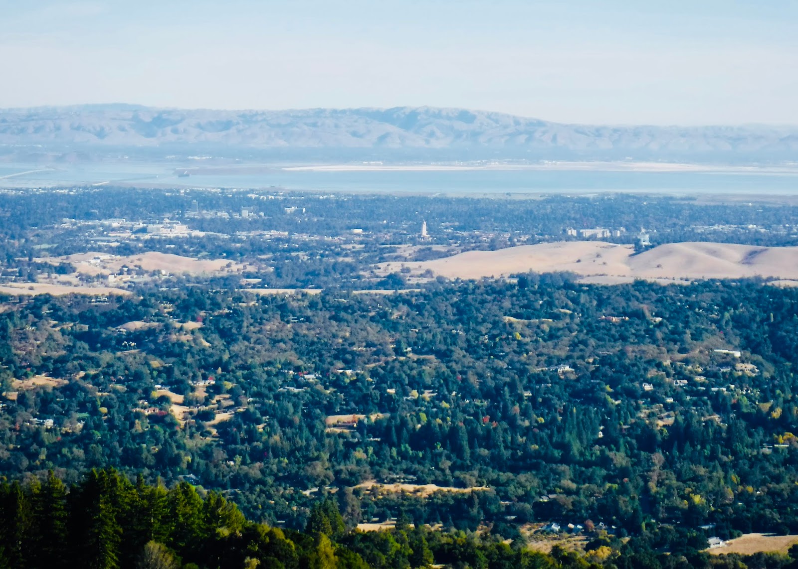
We then continued uphill on the Sunny Jim trail, which passes through a forest of interior live oaks before descending to Horseshoe lake. You can look east to Monte Bello Ridge. Along the way you will notice unclaimed Christmas trees that are left over


from a Christmas tree farm operated by the Wasserman family from the late 1950's until 1982, when the property was acquired by the Midpeninsula Regional Open Space District. Our route then looped around Horseshoe Lake and back to the parking lot. Horseshoe Lake, named because of its shape around a central hill, was also created by John Rickey in the 1950's.

TO GET THERE... The main entrance is on the west side of Skyline Boulevard about a mile south of where it intersects Page Mill Road/Alpine Road.

Saturday, November 3, 2018

Hiking Downhill One-Way at Windy Hill Open Space Preserve

Because there is a 1,600 foot elevation difference between the top of Windy Hill and the preserve parking lot at the bottom along Portola Road, a loop hike in this steep preserve can be long and strenuous. For that reason I arranged for my College of San Mateo class to car shuttle from the Portola Road entrance to the entrance at the northern parking area to the preserve on Skyline Boulevard to begin our outing.

We gathered at the Portola Road entrance in Portola Valley to arrange the car shuttle. This is a popular entrance, so it is a good idea to arrive by 9:00 am on weekends. There are additional parking spaces along the east side of Portola Road across from the parking lot entrance, and more parking .4 miles north at the Portola Valley town hall. We carpooled north on Portola Road and then west (uphill) on Highway 84, and south on Skyline Boulevard. We parked at the parking lot on the east side of Skyline Boulevard at the Spring Ridge Trailhead.

We took the Anniversary Trail uphill to the summit of Windy Hill, where we enjoyed spectacular views of the Pacific Ocean to the west and San Francisco Bay and the Bay Area cities to the east. We could see all the way north to Mount Tamalpais to the north, Mount Diablo to the northeast, and Mount Hamilton to the southeast. Salesforce Tower in downtown San Francisco was visible. We could also make out the path of the San Andreas Fault below to the east. George and Karen flew their kite on the breezy and treeless summit. Continuing south on the Anniversary Trail we stopped at the outhouse at the picnic area.

The Lost Trail continues south and east, entering a beautiful stand of Douglas fir as it intersects the Hamms Gulch Trail.  This trail makes the long descent from the moist Douglas fir ridge to the drier oak woodland below. We saw lots of buckeye seeds hanging on leafless buckeye trees and madrone trees bursting with bright orange berries. At the bottom we approached Corte Madera Creek, which still has flowing water despite the lack of recent rain. There we saw a banana slug and a sandstone rock with seashells embedded.

Heading north on the Spring Ridge Trail we saw many magnificent ancient white oaks and live oaks. One of them is a granary tree with lots of holes made by acorn woodpeckers and stocked with acorns.  We even watched a woodpecker inserting acorns into the holes. Continuing north we approached the sag pond, which formed where the earth sags along a bend in the San Andreas Fault. There we were amazed to see a great blue heron attempting to eat a snake.

TO GET THERE... From Highway 280 take Sand Hill Road or Alpine Road to Portola Road in Portola Valley


. The parking lot is south of the town hall. The uphill entrance is on Skyline Boulevard 2.3 miles south of where it intersects Highway 84 or 4.9 miles north of where it intersects Page Mill Road.


Sunday, October 28, 2018

San Mateo County Memorial Park Loop Hike

San Mateo County Memorial Park is only about 500 acres, so it is not hard to do a 6.1 mile loop hike that covers almost the entire park. This hike will take you through shady old-growth redwood groves along beautiful Pescadero Creek and then up onto a chaparral and oak ridgetop with views of the valley and Skyline Ridge.

This is San Mateo County's first county park, dedicated on July 4, 1924 to the 52 San Mateo County residents who died in World War I. Roy Cloud, San Mateo County school superintendent, got the idea when he saw a for sale sign on the property after visiting a one room school house on Wurr Road.

We started our hike at the parking lot on Wurr Road, which is just west of the main park entrance. This is also an entrance to Pescadero Creek County Park. You can avoid the entrance fee by parking here. From the parking area we walked downhill (north) and across the bridge over Pescadero Creek, where there is a trail into the park on the left. We followed the road to the Legion Flat Picnic Area, which was constructed  by the WPA in the 1930's amid a beautiful grove of old-growth redwoods along Pescadero Creek. Nearby is a hollow fallen redwood log with a hole in the top and an exit hole on the side. Kids have been climbing on and through this log for generations.

From there we visited a sandy area where a dam once created a swimming hole. It was removed to allow salmon and steelhead to spawn up the creek. We continued west on the Creek Trail to see the biggest tree in the park, which is 13 feet in diameter. The redwoods in this park are not as big as those in Big Basin or Henry Cowell state parks. The trail then passes through the amphitheater and then swings north and through the Azalea Flat Campground.  Near the north end of the campground we entered the Homestead Trail, which can be hard to find because it involves walking through a campsite.

From the Homestead Trail we headed north on the Pomponio Trail. which will take you across Pescadero Road.  There is no crosswalk, so be careful crossing. The Pomponio Trail loop climbs above the redwoods into stands of Douglas fir, Bay Laurel, hazelnut, thimbleberry, and honeysuckle. On the south facing side of the ridge the vegetation turns to chaparral and oak. In October you can enjoy California fuchsia in bloom.

Next we turned left onto the Mount Ellen Summit Trail, which follows a


ridgeline before steeply descending back to Pescadero Road and the main entrance to the park. We rested at the memorial grove near the park headquarters and then walked the road through the picnic area, which has an ancient redwood with an arched hole that is a good photo op,

TO GET THERE... Wurr Road intersects Pescadero Road southwest of Sam McDonald County Park and is about 10 miles east of Highway 1. It is just west of the main entrance to San Mateo County Memorial Park. The Wurr Road sign is hard to see, so look for the sign that says "Redwood Glen".

Thursday, October 25, 2018

The Top of Mount Umunhum (Sierra Azul Open Space Preserve)

The Midpeninsula Regional Open Space District has done an extraordinary job of cleaning up the old Cold War era air force station atop Mount Umunhum and making the 3,486 foot summit accessible. You can drive to near the top of the mountain, but I think it is more fun to hike the 3.7 mile (one way) scenic Mt. Umunhum Trail from the Bald Mountain parking lot along Mount Umunhum Road.

Along the Mt. Umunhum Trail there are lots of beautiful views. Vegetation includes wild fushsia, bay laurel, wild nutmeg, madrone, gray pine, and manzanita.

From atop the peak on a clear day you will enjoy spectacular views of the Santa Clara Valley and the bay to the east, San Francisco and Mount Tamalpais to the north, the Pacific Ocean to the west, and Monterey Bay and the Santa Lucia Range to the south.

In ancient times the Ohlone revered the top of the mountain. Umunhum is an Ohlone word that means "resting place of the hummingbirds".


In 1957 the summit was occupied by the Almaden Air Force Station (1957-1980), one of the dozens of radar stations operating along the West Coast during the Cold War. The big concrete cubicle was once the base of a big antenna.

Sunday, October 21, 2018

A Coastal Hike at Wilder Ranch State Park

Wilder Ranch State Park, just west of Santa Cruz, has a rugged and spectacular coastline that can be explored via the Ohlone Bluff Trail. The problem is that it is a one-way trail. In order to hike the route going one way my College of San Mateo class carpooled from near the main entrance to the parking area for 4 Mile Beach, which is a 1.9 mile drive on Highway 1.  In order to avoid paying the $10 parking fee we met at the parking area along Highway 1 just east of the main park entrance. We then carpooled to our trailhead.

Four Mile Beach is a big and popular beach. From there we ascended the bluffs and headed east, skirting around 3 Mile Beach. We passed a vast field of Brussels Sprouts. There are spectacular views of sea stacks and cliffs plunging into the Pacific. We stopped for lunch at Strawberry Beach, where we observed seaweed and pelicans skimming above the water. After lunch we took a footpath down the cliff to Sand Plant Beach and up the other side. for more beautiful ocean views. The weather was perfect. Keep an eye out for a rock shelf just below the cliff for hundreds of harbor seals, who haul out there to rest. Soon after is a side trail that descends to a small beach with the Fern Grotto. This ancient sea cave has lots of ferns hanging from the ceiling and water perpetually dripping, even in the dry season. Adventure seekers crawl deep into the cave with flashlights.

I had almost given up seeing a sea otter when we spotted one just before the trail turns inland at Wilder Beach. Sea otters can be found as far north as Ano Nuevo State Park.

After the hike we walked to the Cultural Preserve where the Heritage Harvest Festival was going on. There is a cluster of historic ranch buildings, including houses, bunk house, granary, horse barn, cow barn, blacksmith shop, and an adobe going back to Mexican times in the early nineteenth century. In the shop you can see lots of late nineteenth century technology run by a pelton wheel. If you arrive during the harvest festival you will see lots of docents in period costumes demonstrating how people lived in the old days.

TO GET THERE... The main entrance is 2 miles west of Santa Cruz on Highway 1.


Sunday, October 14, 2018

Fall Creek Unit of Henry Cowell Redwoods State Park

Near the town of Felton there are two units of Henry Cowell Redwoods State Park. Yesterday my De Anza College class enjoyed a 6.3 mile ramble through the Fall Creek unit, which is a steep, forested canyon northwest of town. The best thing about this park is Fall Creek itself. Fed by numerous springs, the creek runs cold and pure all year as it tumbles over granite and limestone on its way to the San Lorenzo River. You won't need sunscreen or hat in this shady canyon.

We started our hike at the parking lot on the north side of Felton Empire Road, a short distance west of Highway 9. We hiked downhill, past Bennett Creek to the Fall Creek Trail, which follows South Fall Creek to the lime kilns, which were built by the IXL Lime Company in 1870. Limestone, quarried from nearby Blue Cliff, was stacked into the kilns and heated to about 1700 degrees F for several days by continuously feeding redwood firewood into the arched entrances. The resulting lime was then put into barrels, which were made nearby. Lime is used to make cement and to neutralize acid soil. Nearby is the Powder Magazine, where explosive powder was stored, and just behind it is a concrete basin with a dozen or so goldfish.

From there we walked east and north on the Cape Horn Trail, which took us to our lunch stop along Fall Creek. After lunch we headed upstream on the Fall Creek Trail to the Barrel Mill Area. At this time part of the trail is gone due to a landslide. Proceed with caution. Iron equipment at the Barrel Mill Area was used to mill lumber from an upstream lumber mill into barrel staves. We then proceeded back downstream on the Fall Creek Trail which makes five bridge crossings of Fall Creek.


TO GET THERE... From Highway 9 in Felton, the main parking lot is less than a mile northwest on the Felton-Empire Road.

Sunday, October 7, 2018

Tarwater Loop Trail at Pescadero Creek County Park

I lead my College of San Mateo class on a wonderful 5.4 mile loop in Pescadero Creek County Park yesterday. We met at the parking lot at the town hall in Woodside to carpool. From there we drove uphill on Highway 84 to Skylonda, turned south on Skyline Boulevard and west on Alpine Road. We continued on Alpine Road past the turnoff to Portola State Park and headed south on Camp Pomponio Road, which can be easily missed. Look for the sign that says "Pescadero Creek County Park 7546 Alpine Road". Continue south on the narrow one-lane paved road until you reach the parking lot on the left. Pescadero Creek County Park is the largest County Park in San Mateo County, but it is not heavily used because the entrances are rather obscure.

From the Tarwater trailhead we headed downhill (south) on the Tarwater Trail. It passes a huge ancient redwood tree that I have measured at 15.5 feet in diameter. Look up the enormous trunk to see a grove of reiterations high above. We continued downhill and paused at the site of the Moore, Fisher & Troupe lumber mill, where there is a large abandoned iron boiler used for powering the saw that cut railroad ties. It was established in 1915.

From where the trail meets a dirt road we continued south on the Bridge Trail, which crosses Pescadero Creek. We stopped for lunch on the south side of Pescadero Creek, which is the biggest creek in San Mateo County. We saw a large crawdad in the creek.

After lunch we headed back up the Bridge Trail and turned west on the Pomponio Trail, which connects with the Camp Pomponio Road. We walked west a short distance on that road to the continuation of the Tarwater Trail Loop. From there it is a long uphill hike along Tarwater Creek. We took a short detour to see a tar seep that gives the creek its name. This route climbs above the redwoods and into an oak woodland and grassland where an old dairy barn still stands.


TO GET THERE.. From Skyline Boulevard take Alpine Road west  and turn south on Camp Pomponio Road. This is one of several entrances to this park.

Sunday, May 6, 2018

A Perfect 7-Mile Hike at Big Basin Redwoods State Park

The best hike in Big Basin Redwoods State Park is the 11-mile loop that includes Berry Creek Falls, Silver Falls, and Golden Falls. If that one is a bit too much, here is a shorter alternative.

Yesterday my De Anza College class carpooled to the Big Basin park headquarters area. If you arrive by about 9:30 am on weekends you can beat the crowds and find a nearby parking space. Before hitting the trail we posed for a photo at the giant burned-out redwood to the left of the restrooms.  This is the ultimate redwood photo op. We then entered the visitor center, built in the 1930's, to view a wide panoramic photo taken by Andrew P. Hill about 1900 to promote the creation of California's first state park, which was established in 1902. Big Basin is the biggest park in the Santa Cruz Mountains.

We then headed for the vertical "REDWOOD TRAIL" sign to begin our 7-mile hike. We turned left on the Redwood Loop Trail to see some of the most iconic ancient redwoods in the park, including the Mother of the Forest, the Father of the Forest, the Telescope Tree, and the Animal Tree. The Father of the Forest is probably the biggest tree in the Bay Area. We paused to get a drink at the Andrew P. Hill memorial fountain, but the faucet is in need of repair.

The Redwood Loop Trail ends at a restroom just before crossing the bridge over Opal Creek. From there we took the Skyline-to-the-Sea Trail past more huge trees and then ascended to the top of the ridge. From there we turned left and proceeded uphill on the Howard King Trail to the Hihn Hammond Road. We continued uphill on this road to the Mount McAbee Overlook, which offers great views into Waddell Canyon and on to Waddell Beach. We stopped here for lunch. This route climbs above the old-growth redwoods and into a forest of Douglas fir, second-growth redwoods, madrone, tanbark oak, and knob cone pine.

After lunch we took the Howard King Trail to the east, with great views of Pine Mountain and Buzzard's Roost. We then followed the Hihn Hammond Trail downhill to the bridge over Opal Creek, which is a great swimming hole on a warm day. From there we followed Opal Creek on the Hih


n Hammond Connector Trail, which took us to the Skyline-to-the-Sea Trail and then back to where we started.

Along our route we saw redwood violets, two-eyed violets, Douglas iris, lupine, Solomon's seal, yerba santa, bush poppies, chaparral pea, sticky monkey flower, several species of ferns, horse tail, banana slugs, and three species of lizards.

TO GET THERE... From Skyline Boulevard take Highway 9 southwest and turn west on Highway 236 at Waterman Gap or at Boulder Creek. This is a narrow winding road from Waterman Gap.