Sunday, April 28, 2019

A One-Way Downhill Hike on Windy Hill

Windy Hill Open Space Preserve is an extraordinarily scenic and ecologically diverse1,335-acre piece of the Santa Cruz Mountains. The problem with picking this preserve for my College of San Mateo and De Anza College field trips is that a loop hike from the bottom  to the top would greatly exceed the 4.5-6.5 mile field trip parameters, not to mention an elevation gain and loss of about 1,400 feet.  To keep the distance down to a manageable distance we used a car shuttle from the Portola Valley entrance to the northern Skyline Boulevard entrance and then, after ascending to the summit of Windy Hill, it is virtually all downhill. Our one-way hike was about 5.3 miles.

The problem with carpooling from the Portola Road entrance in Portola Valley on a Saturday is that this is a very popular hiking/biking/running/dog walking destination. The parking lot was completely filled by the time I arrived at 8:45 am and I grabbed one of the last roadside parking spaces along Portola Road near the preserve entrance. When the students arrived after 9:00 am I directed them to the parking lot about .4 miles north at the Portola Valley Town Center. There is a footpath that connects the Windy Hill parking lot with the town center.

We carpooled about 8 miles to the northernmost Windy Hill parking lot, which is north of the main parking lot with the picnic tables. From there we hiked uphill to the breezy and aptly named summit. On a clear day you can see San Francisco Bay and the Pacific Ocean from the same place. We could see the bay, but the coast side was obscured by clouds.

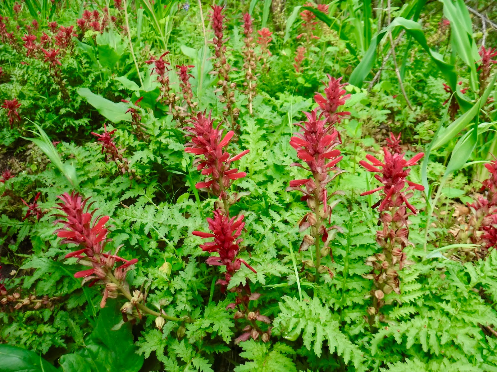
From there it was nearly all downhill on the Anniversary Trail, Lost Trail, Hamms Gulch Trail, and Spring Ridge Trail. There was a short segment of the Hamms Gulch Trail that was washed out and required a muddy climb over a fallen tree. We saw many wildflowers along the way, including dandelions, poppies, checker bloom, lupine, cow parsnip, forget-me-nots, giant wake robin trilliums, milkmaids, both fat and slim Solomons seal, crimson columbine, and blue dicks. The ecology changes dramatically as the route descends from the moist Douglas fir forest near the summit to the drier oak woodlands at the bottom.

Near the bottom of the hike we crossed the San Andreas Fault, which forms the boundary between the Pacific Plate and the North American Plate. Near the end of our hike we passed Sausal Pond, which is a sag pond formed by a curved section of the fault that subsided. In the pond we saw two bull frogs and a pond turtle.


TO GET THERE... From Highway 280 take Alpine Road or Sand Hill Road to Portola Road. The trailhead is just north of the Sequoias retirement community in Portola Valley.

Monday, April 22, 2019

A Windy & Foggy Day on Sweeney Ridge

Sweeney Ridge can be a risky place to plan a field trip. The 1200 foot high ridge can be spectacular, with views of both the Pacific and the bay, or it can be socked in with fog. Unfortunately, my College of San Mateo class field trip on April 20 was the worst day of the week to hike the ridge top. The day before was beautiful, and the day after was even more beautiful, but the the day of the field trip was foggy, cold and windy.

We met at the west end of Sneath Lane in San Bruno to arrange a car shuttle to our starting point at Skyline Colllege. That way  our 5 mile outing was one way. Other wise you have to go in and out the same way. From Sneath Lane we took Skyline Boulevard north, and turned left (west) on College Drive to Skyline College. On weekdays you can park in parking lot C, next to the trail head. On weekends the closest parking is in parking lot F. No parking permit is needed on weekends.

From parking lot C the trail heads uphill and south, climbing to a high point where the abandoned Coast Guard station stands covered with graffiti. It then makes a steep descent and a steep ascent to the Sweeney Ridge. Continue south, past the site of the Nike Missile radar station. The station buildings were recently removed as part of a toxic waste cleanup.

Though the fog obscured our views, we saw lots of beautiful wild flowers, including footsteps to spring, checker bloom, lupine, poppies, Douglas iris, goldfield, twin berry, Indian paintbrush, crimson columbine, blue witch, and cow parsnip.

Normally we would have stopped for lunch at the stone monument marking the place where the Portola expedition first saw San Francisco Bay on November 4, 1769. However, because it was too


cold, windy, and foggy we skipped lunch and headed downhill on the paved road/trail and back to the west end of Sneath Lane, where we car shuttled the drivers back to their cars at Skyline College.

TO GET THERE... From Highway 280 take Sneath Lane exit and proceed to the end of Sneath Lane in San Bruno.

Sunday, April 14, 2019

Almaden Quicksilver County Park from the Hacienda Entrance

There are 4 entrances to Almaden Quicksilver County Park. My De Anza College field trip yesterday met at the Hacienda entrance which is along Almaden Road near the community of New Almaden. There is a large parking lot with restrooms.

This 3,977-acre Santa Clara County park, in the dry eastern foothills of the Santa Cruz Mountains, is well known for its colorful mercury mining history and for its extraordinary display of spring wildflowers. Despite nearly 130 years of mining and settlement much of this land still feels wild. It is amazing how quickly this land has healed.

My De Anza class took a 6.1 mile loop that ascended the Mine Hill Trail, with a short side trip to the powder house, where we were surprised to see several bats flying around in daylight.  We continued uphill to the San Cristobal Mine for lunch. Unfortunately, visitors are no long allowed to enter a short distance into the mine. We continued our


long and steady uphill to Bull Run, where we paused to enjoy views of Mount Umunhum and Loma Prieta, which is the highest point in the Santa Cruz Mountains. We stopped to look at lots of beautiful wild flowers, including, fiesta flowers, blue dicks, Indian paintbrush, buttercups, shooting stars, wild cucumber, mule ear, blue eyed grass, Johny jump-ups, wild onion, and golden poppies.

From Bull Run we headed east on the Castillero Trail, where we viewed the abandoned rotary furnace, and then headed north to see the remains of English Camp. From there it is a steep downhill on the Deep Gulch Trail to a flat area at the bottom where there is old mining equipment to be seen.

After the field trip some of us stopped at nearby Casa Grande, which used to be the mine foreman's house and office, but which is now an excellent mining history museum.

TO GET THERE... From Highway 85 take Almaden Expressway south and turn right on Almaden Road to the Hacienda parking lot.

Portola Valley Trails and Windy Hill Open Space Loop

On April 6 I lead my College of San Mateo class on a loop hike that included Coal Mine Ridge in the town of Portola Valley and Windy Hill Open Space Preserve. We met at the trail head at the intersection of Alpine Road and Willowbrook, which is in the town of Portola Valley. If the parking lot is full you can find additional


parking along Willowbrook.

Portola Valley is an affluent community with a wonderful trail system that combines residential and woodland areas. Along the San Andreas Fault, this land is a pleasant patchwork of woodlands and grassy meadows, with sag ponds formed by movement on the fault.

We followed the Old Spanish Trail, which has lots of beautiful white, black, and live oaks. There is even a swing hanging from an oak limb a short distance off the trail. Being on the dry east side of the Santa Cruz Mountains, this is a perfect place to see wildflowers in late March through April. We saw checker lilly, star zygadine, buttercups, Douglas iris, Indian warrior, sun cups, and giant wake robins, among others.  We stopped at one of two large sag ponds for lunch.

From the end of the Old Spanish Trail we turned right onto the Lake Trail, which connects with Alpine Road. Because Alpine Road is a dead end, there is little motor traffic and it is shared by cars, horses, hikers, and bicycles. We continued down Alpine Road to the Eagle Trail and then crossed the stone bridge to the other side of Corte Madera Creek, where we picked up the Hamms Gulch Trail in Windy Hill Open Space Preserve. We then made the next right turn, which took us across a bridge and back to where we started on Alpine Road.