Saturday, April 30, 2016

Long Ridge Open Space Preserve (from Saratoga Gap to Grizzly Flat)

This 5.3-mile ramble on Long Ridge requires a car shuttle. My De Anza College class met at Grizzly Flat parking lot, which is along Skyline Boulevard about three miles north of where it intersects Highway 9. We then carpooled south to Saratoga Gap, which is at the intersection of Skyline Boulevard and Highway 9. From there we walked one-way back to Grizzly Flat.

First, we crossed to the west side of Skyline Boulevard, where we picked up the Skyline-to-the-Sea Trail. This trail, which ends at Waddell Beach in Big Basin Redwoods State Park, was built by volunteers between 1969 and 1976. We hiked about .4 miles west on the portion of this trail that was built in 1871 as the Saratoga Toll Road. We then took the first turn to the right, which crosses Highway 9 and connects with the Achistaca Trail in Long Ridge Open Space Preserve.

The Achistaca Trail closely parallels Skyline Boulevard for 1.7 miles as it passes through a Douglas fir and canyon live oak forest. At the north end of this trail we turned left (west) on the Hickory Oaks Trail and then took an alternate route to the top of a hill with spectacular views of the Pescadero Creek watershed and beyond. After pausing for lunch we sampled bay nut brownies I baked and recounted the Ohlone Indian creation story at Turtle Rock. From there we continued west on the Hickory Oaks Trail and turned right on a foot trail that connects to the Long Ridge Road Trail. We then turned right and downhill through a woodland to a beautiful pond along the Peters Creek Trail. Most of the pond is on property owned by the Jikoji Zen Center. From there we headed north on the Peters Creek Trail and made a right turn at the junction to the trail that goes uphill to Grizzly Flat.

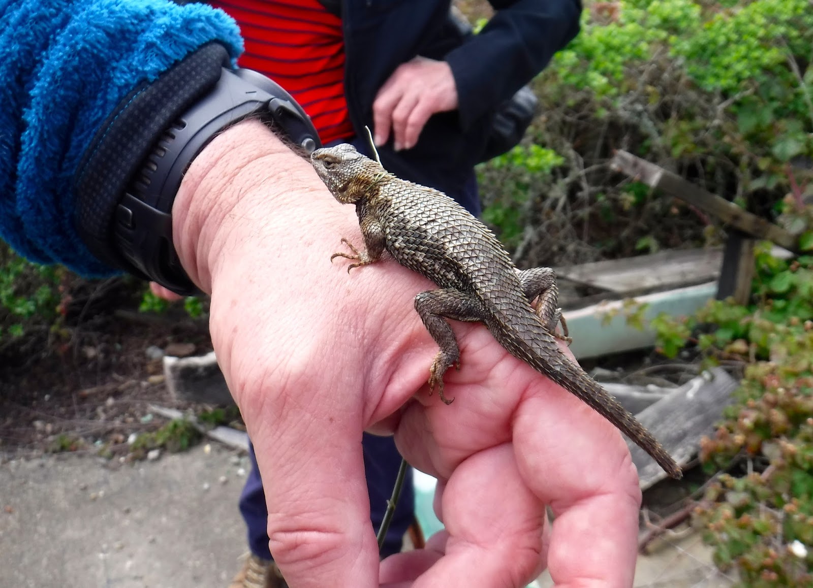
The weather was sunny, and there was no fog or clouds to obscure our view all the way to the blue Pacific. We saw many wildflowers, including vetch, Indian paintbrush, Douglas iris, blue dick, baby blue eyes, buttercup, manzanita, wart-leaf ceanothus, linanthus, mule ear, blue-eyed grass, golden poppy, red maid, checker bloom, two-eyed violet, stinging nettle, and wild ginger. We also saw a wild turkey and several swallowtail butterflies.

TO GET THERE... the Grizzly Flat trailhead is along Skyline Boulevard about 5 miles south of Page Mill Road, and 3 miles north of Saratoga Gap (Skyline Boulevard & Highway 9).


Sunday, April 24, 2016

History & Wildflowers on Sweeney Ridge

Sweeney Ridge, which is part of the Golden Gate National Recreation Area, can be a risky destination for a field trip. There is always the risk that the exposed ridge top will be windy, cold, and socked in with fog. Yesterday, however, turned out to be a great day for a hike. The rain was gone and spectacular views of the bay and ocean greeted my College of San Mateo class, along with an abundance of wild flowers.

Because there are no loop hiking routes on the ridge, we met at 9:30 am at the west end of Sneath Lane in San Bruno in order to carpool to the trail head at Skyline College. If the small parking lot at the end of Sneath is full, you can park along the residential streets nearby. The trail head at Skyline College is at parking lot C, which is closed to cars on weekends. We parked at nearby parking lot F. There are plenty of places to park on weekends and no parking fee on those days. The total distance of this route is slightly more than 4 miles.


From there we hiked uphill on the Notch Trail, which has a few steep stairway sections. We turned left at the Mori Ridge Trail junction and continued south on the Sweeney Ridge Trail, which took us past the remains of an abandoned Coast Guard station and a Nike Missile control station. Sweeney Ridge was the radar station for detecting and tracking approaching enemy aircraft. The missiles were stationed on Milagra Ridge to the north. One of my students fashioned a grass noose to catch a blue-belly lizard. We enjoyed lots views of both the Pacific Ocean and San Francisco Bay along the way, and we stopped frequently to enjoy the many wildflowers.

We stopped for lunch at the monument that marks the site where the Portola expedition first sighted San Francisco Bay in 1769. The monument gives November 4 as the day of discovery, though scouts from the expedition ascended the ridge and saw the bay on November 2. It is a great place for lunch, with spectacular views of much of the Bay Area and the coast.

After lunch it was all downhill on the paved Sneath Lane trail to the entrance gate on Sneath Lane. We had a good view of the San Andreas reservoir and the San Andreas Fault rift valley in which it rests. We saw so many wildflowers it is hard to mention them all. They included Douglas iris, bee plant, sticky monkey flower, yarrow, flax, checker bloom, lupine, Indian paintbrush, poppies, wild cucumber, twin berry, blue dick, daisies, ceanothus, poison oak, gold field, columbine, mugwort, holly leaf cherry, larkspur, elderberry, vetch, seep monkey flower, and hedge nettle. One of the students asked me about a plant with a long stem and little red flowers. I later looked it up and identified it as fringe cups.

TO GET THERE... From Highway 280 take Sneath Lane in San Bruno and continue west to the locked gate. To reach Skyline College from Highway 280 take Sneath Lane west, turn north on Skyline Boulevard, and left on College Drive to Skyline College. Park at parking lot C on weekdays and parking lot F on weekends.

Tuesday, April 19, 2016

March Showers Bring April Flowers to Edgewood County Park

Drop whatever you are doing and head for Edgewood County Park, at the intersection of Edgewood Road and Highway 280 in Redwood City. This is a great year to see the explosion of Spring wildflowers, especially on the serpentine grassland parts of the park.

Serpentine, associated with fault zones, provide poor soil for the non-native grasses that have taken over most of our non-forested hillsides. This allows native flowering plants that are adapted to serpentine soils to thrive.


TO GET THERE... The main entrance is on the south side of Edgewood Road about 1.5 miles east of Highway 280. There are also a few parking places on the south side of Edgewood Road just west of Highway 280, with a trail that goes under the freeway and into the park. You can also park along Canada Road just east of Highway 280 and take the Clarkia Trail, which begins on the east side of the road.

Sunday, April 17, 2016

A Beautiful Day at Calero County Park

Yesterday was a perfect day for a field trip with my De Anza College class at Calero County Park, which is in the eastern foothills of the Santa Cruz Mountains south of San Jose.

We met at the large parking lot (no parking fee), which is just off McKean Road south of the reservoir. From there we began our 6.1-mile figure-8 hike by heading uphill on the Los Cerritos Trail and pausing at a pretty little pond to enjoy the songs of red wing blackbird. We then turned left on the Pena Trail to an intersection with an old corral. Take your time on this first part of the outing because parts of it are very steep.

From there we turned left on the Javelina Loop Trail, which makes a gentle ascent to where we stopped for lunch at a pretty pond at Fish Camp. There is a picnic table and benches on a platform overlooking the pond. After lunch we continued uphill to the west to a serpentine outcrop with great field of poppies and goldfield. This part of the trail is pretty steep in places. As the trail turns north and heads downhill there are some good views of the Calero Reservoir, and lots of wildflowers in the serpentine grassland, by stepping off the trail a short distance. The Javelina Loop Trail then heads east, passing a large elevated structure designed for bats to sleep during the day.  From there we continued back to the intersection with the old corral.

From the intersection we completed our double loop by taking the Figueroa Trail, which avoids the necessity of ascending the steep hill at the beginning of the hike. This 1.9-mile finish to our figure-8 is very gentle and offers wildflowers we had not seen earlier. At the end we chopped off some of the distance and elevation gain by climbing over a locked gate.

This park becomes hot and dry after about May 15. April is the perfect month to visit if you want to see lots of wildflowers and to enjoy mild temperatures. We saw Ithurial's spear,  purple vetch, blue-eyed grass, globe gilia, blue and white blue dicks, golden yarrow, golden poppies, goldfield, hedge nettle, linanthus, black sage, globe lilly, mule ear, checker mallow, Johnny-jump-up, and fiddlenecks.
Magnificent blue, white, black, and live oaks are one of the charms of this park year around. These ancient oaks have contorted branches that reach in all directions, even down to the ground and back up again.

TO GET THERE... from Highway 101, south of where it intersect Highway 85 in San Jose,  take Baily Avenue west and turn south on McKean Road. Look for the Calero County Park entrance on the left.


Saturday, April 9, 2016

A Rainy Loop through Stevens Creek County Park & Fremont Older Open Space Preserve

Today my College of San Mateo class enjoyed a moist but enjoyable ramble through Stevens Creek County Park and Fremont Older Open Space Preserve on the east side of the Santa Cruz Mountains.

It was with a bit of trepidation that we began our 7.1 mile hike from the Stevens Creek County Park parking lot just off Stevens Canyon Road in Cupertino. Accuweather promised passing showers as we he headed out into a gentle April shower. We hiked south on the Stevens Creek/Tony Look trail through a verdant forest of bay, maple, buckeye, and oak, with beautiful views of the Stevens Creek Reservoir.

The forest was as green and wildflowery as it could be. We stopped to examine globe lilies, poison oak, pollywogs in a puddle, golden yarrow, mule ear sunflowers, a hillside of chia flowers, blue and red lupines, blue witch,  iris, wild cucumber flowers and fruit,  pitcher sage, yerba santa, Indian paintbrush, Chinese houses, larkspur, golden yarrow, Ithurial's spear, crimson columbine, chaparral clemitus, owl clover, vetch, and blue elderberry.

Showers turned to steady rain about the time we reached the group picnic area. Though the restrooms were locked, there was an overhang on each end of the building that afforded us some shelter until rain turned to drizzle. Then we took a vote. Despite my warning that continuing the planned loop would involve an uphill climb followed by hiking on a dirt road trail on an exposed ridge, the overwhelming consensus was to continue the loop. We ascended the ridge and then crossed over into Fremont Older Open Space Preserve. From there we followed the Vista Loop Trail, the Fern Trail, and the Coyote Ridge Trail back to the county park and the parking lot. Fortunately, heavy rain did not commence on this part of the hike, though the trails were quite muddy.  Despite the wet and muddy conditions everyone seemed to have a very good time.

TO GET THERE... From Highway 280 take the Foothill Avenue exit and proceed west on Foothill, which turns into


Stevens Canyon Road. The park entrance is on the left about 3 miles southwest of Highway 280.

Sunday, April 3, 2016

Butano State Park Loop Hike

Yesterday I lead my De Anza College class on an 8-mile loop hike in Butano State Park. We parked at a small parking area where a service road intersects the main park road. A backpacker told one of my students that she could park behind him for the day because he would not be returning to his car until the next day. Unfortunately, a ranger came by later and gave her a ticket. She will appeal.

Walking uphill from the parking lot we continued past the turnoff to the campground and headed northeast on a dirt road and then turned right onto the Goat Hill Trail. This route took us uphill to where it intersects the Doe Ridge Trail. We followed this trail east to where it intersects the Olmo Fire Road on the ridge top. From there we walked a short distance uphill for lunch at a place where knob cone pines grow and beautiful views are to be enjoyed. After lunch we headed southwest on the Olmo Fire Road to the turnoff for the Goat Hill Trail. This trail took us west to the service road that ends at the parking lot where we began.

This route starts in the cool shady redwood forest where the ground is covered with ferns and sorrel and climbs to the sunny ridge top where oaks, pines, and manzanita abound. Along the way we saw clintonia (though not yet in bloom), redwood sorrel, sword ferns, a yellow-eyed salamander, banana slugs, an artist's palette fungus, turret spider tubes, flowering ceanothus, bush poppies in bloom, knob cone pines,  and lots of flowering Douglas iris.

There was controversy among our group about which route to take to get to Butano from the Santa Clara Valley area. I organized a carpool from Los Gatos that took us south on Highway 17 and then north on Highway 1, east on Gazos Creek Road, and north on Cloverdale Road. Others in our group said that Google recommends taking Highway 280 north to Highway 92, and then south on Highway 1. The shortest distance would be to take Highway 84 through the Santa Cruz Mountains from Skyline Boulevard. However, that route involves winding mountain roads that would probably take longer than the other two. Which ever route you take, this is one of the most remote parks in the Santa Cruz Mountains.