Sunday, April 30, 2017

A Figure 8 hike in Calero County Park

Calero County Park, south of San Jose, contains a reservoir and 3,476 acres, with trails that continue into adjacent Canada Del Oro Open Space Preserve. On the dry east side of the Santa Cruz Mountains, this park is hot and dry from late Spring until early Fall. I like it best from late March until mid-May when the grassy hills are green and there are lots of wild flowers.

Yesterday I lead my College of San Mateo class on a 6.1 mile figure 8 loop that left from the main parking lot off of McKean Road. With some steep uphill sections this was the most strenuous of the three field trips for this class. We took the Los Cerritos Trail uphill, past a little pond, and then turned left and up a steep section of the Pena Trail. We stopped to admire beautiful blue oaks, live oaks, and white oaks.

At an abandoned corral amid a bay tree woodland we continued on the Javelina Loop Trail to a small pond with a picnic trail, where we stopped for lunch. From there we continued uphill, past a serpentine grassland, and then downhill where we enjoyed a view of the reservoir. We then headed east on the Javelina Loop Trail to the Bat Inn, a structure that houses thousands of bats during the day. This section of trail has some steep uphill parts. Back at the corral intersection we hiked the Figueroa Trail, which parallels Calero Creek back to the parking lot. Some of us took the short cut by climbing over the gate.

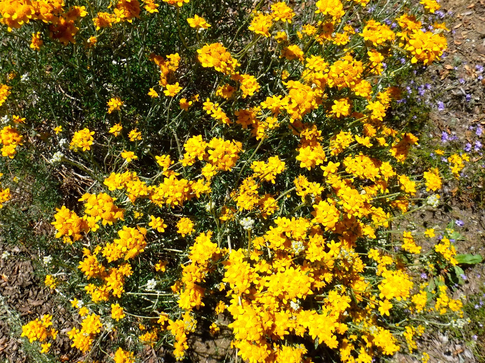
Along the way we stopped to look at Persian clover, wild mustard, rose clover, blue eyed grass, vetch, black sage, coast sage, golden yarrow, blue dick, gilia, Ithurials spear, blow wives, linanthus, poppies, and blue elderberries.

TO GET THERE... from Highway 101 southbound from San Jose take Bernal Road west and turn south on McKean Road to the park entrance on the right.


Sunday, April 23, 2017

A Springtime Ramble at La Honda Creek Open Space Preserve

Though La Honda Creek Open Space Preserve covers 5,700 acres, only a small part of it is currently open to the public. And that part is only open by getting a special use permit, driving a private road, and entering through a locked gate. The small parking lot accommodates only six vehicle. You can get a free permit by visiting the Midpeninsula Regional Open Space District website.

Yesterday I lead a field trip for my De Anza College class on what passes for trails in this preserve. The trails are mostly old ranch roads and faint routes that may not even be recognizable as trails. We met at the Woodside town hall in Woodside to carpool to our destination. From there we walked uphill to a small private property enclave and then continued east on the dirt road to a telephone pole with the number 8. That marks the .1 mile trail downhill to an old-growth redwood identified on the map as Big Tree.  We then retraced our route back to the house and continued south on the ranch road beyond the concrete garage.

Continuing south over green grassy hills, we enjoyed views of the surrounding mountains and seashore and then entered a second-growth redwood grove with a burnt old-growth redwood and a strange tree with a bulging base. From there we continued to a grassy overlook called Vista Point, where we stopped for lunch.

After lunch we retraced our steps to a grassy hilltop with lichen encrusted sandstone outcrops and then took a faint trail downhill and to the west. At the bottom of this trail are pieces of sheet metal where I usually find snakes. At this time all I found was one ring neck snake.  We also saw a blue-belly lizard and an alligator lizard nearby.  From there we took the ranch road uphill and back to the parking lot.

Along our route we saw Douglas iris, California poppies, blue-eyed grass, checker bloom, vetch, blue dicks, wild cucumber, filaree, owls clover, and many other wildflowers.

This property was purchased in the late 1940's by an airline pilot named Dyer, who flew a United Airlines route from New York to Hawaii. He ofter flew over the Santa Cruz Mountains and admired this grassy ridge top amid a forest and decided that it would be a good place to live. When in the Bay Area he contacted the owner of the property and bought it. When he called his wife, she was so excited she loaded up their possessions and drove their Ford pickup truck across the country and joined him. That truck is now in the concrete garage. Because the garage windows are too high to peer into without a ladder, I borrowed one from the woman who lives in the nearby house. I have included a photo.


TO GET THERE... Because this entrance is accessible via narrow roads, one of which is private, and there is a locked gate, you must get a permit before entering.

Saturday, April 15, 2017

Wildflower Explosion at Edgewood County Park & Preserve

Wild flowers are blooming in profusion in the serpentine grasslands of Edgewood County Park & Preserve. Great crowds of people are jamming the main entrance on Edgewood Road for free weekend nature walks. To avoid the crowds take Edgewood Road west to where it ends and then turn left (south) on Canada Road, go under the freeway, and park in a dirt parking area on the west side of the road. Across from the parking lot begins the Clarkia Trail, which takes you into the park.

My College of San Mateo class met at the Clarkia Trail entrance to begin a 4.6 mile counter clockwise loop around the park. From the Clarkia Trail we headed right on the Sunset Trail


to the Serpentine Trail, with a brief side trip to see a rare blue rock called blue schist. We then followed the Serpentine Trail, turning right on the Franciscan Trail, left on the Edgewood Trail and then back to the Clarkia Trail by way of the Sunset Trail.

It is easy to see what parts of the park have serpentine soil by the profusion of wild flowers. Serpentine is the state rock of California. Associated with earthquake faults, it is low in calcium, nitrogen, and potassium, and high in nickel and chromium. This chemical composition makes it infertile and a difficult environment for plants that are not adapted to growing there. As a result, non-native annual grasses, which dominate most hillsides do poorly, and plants that evolved to grow in serpentine soil thrive.

Among the many wild flowers we saw sticky monkey flowers, linanthus, tidy tips, purple sanicle, goldfield, larkspur, owl clover, golden poppies, checker bloom, sun cups, cream cups, butter cups, narrow-leaf mule ear, blue eyed grass, and harvest brodiaea. We also saw deer, a wild turkey in a tree, and several fence lizards.

TO GET THERE... From Highway 280 take Edgewood Road west, turn left on Canada Road, and park on the dirt parking lot on the west side of the road just east of the freeway.

Sunday, April 9, 2017

A Rainy/Sunny Hike on Portola Valley Trails

Thirteen of my De Anza College students braved the weather as we set out yesterday for a 6.7 mile loop hike that took us across Coal Mine Ridge in Portola Valley and back by way of Alpine Road and Windy Hill Open Space Preserve.

Despite a steady rain that fell when our class gathered at the trailhead at the intersection of Alpine Road & Willowbrook Drive in Portola Valley, the majority voted to go ahead with the field trip. Fortunately, the rain let up and the remainder of the day was a combination of sunny, cloudy, and rainy.

We followed the Old Spanish Trail along Coal Mine Ridge, which also follows the San Andreas Fault to three sag ponds formed where the land sags at curves in the fault. Some of the students played on a swing attached to an oak limb before we stopped for lunch at one of the ponds. Along the way we enjoyed many wild flowers, including Solomons seal, mission bells, buttercups, sun cups, tomcat clover, owls clover, Indian warrior, lupine, wild onion, poppies, and trillium. The oak woodland is forested with white oaks, live oaks, black oaks, madrone, bay laurel, and big-leaf maple.

After lunch we headed south on the Lake Trail to Alpine Road, which took us downhill as we paralleled raging Corte Madera Creek. This part of Alpine Road is narrow and a dead end, so there is little traffic. We then took the Eagle Trail, which parallels Alpine Road, and then crossed a bridge and turned right on the first trail on the other side of the creek. To get back to the trailhead just take every right turn through Windy Hill Open Space Preserve.


TO GET THERE... From Highway 280 take Alpine Road south. Park on the north side of Alpine Road near the Willowbrook Drive intersection. You can park along Willowbrook if the parking lot is full.

Sunday, April 2, 2017

A Perfect Day at Sam McDonald County Park

Yesterday was warm and sunny. A perfect day for a mostly shady 5.5 mile hike through the redwoods of Sam McDonald County Park, near La Honda. My College of San Mateo class met behind the Pioneer Hotel in Woodside to carpool about 37 minutes to the park. There is a $6.00 parking fee at the county park.

We started at the main parking lot near Pescadero Road. From there we crossed the road and headed uphill on the Towne Fire Road Trail, with a short side trip on the Big Tree Trail to see a magnificent old-growth redwood with two reiterations that make me think it should be called the "stick-em-up tree". As the Towne Trail approaches the ridge the redwoods suddenly give way to grassland. Heading east on the Towne Trail we pass the Horse Camp and then took a side trail to the Sierra Club hikers hut, where we had lunch. Nearby are beautiful views into the forested Pescadero Creek watershed in Pescadero Creek County Park. To reserve the hikers hut contact the Loma Prieta chapter of the Sierra Club in Palo Alto.

After lunch we headed north, downhill, on the Heritage Grove Trail, which passes oak and maple woodlands and then redwoods. We took a side trip to see the old-growth redwoods along Alpine Creek in the Heritage Grove. After stopping to examine a banana slug on a redwood we headed back uphill to the main trail and then hiked west and back to the parking lot.


TO GET THERE... From Skyline Boulevard take La Honda Road west and turn right on Pescadero Road a short distance beyond the town of La Honda. Look for the Sam McDonald County Park sign on the right.