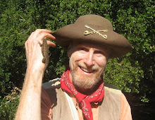
Yesterday I lead my College of San Mateo class on a 4.6 mile figure-8 hike that visits all the major sights in Skyline Ridge Open Space Preserve. It was a beautiful sunny day as we left the parking lot and charged uphill on the Ridge Trail to where it crosses the Sunny Jim Trail. From there we continued west on the Ridge Trail from oak/bay woodlands to grasslands and chaparral.
Spectacular views of the Pescadero Creek watershed and the blue Pacific Ocean (no fog) burst into view as we turned the corner and headed north on the Ridge Trail. We paused to enjoy the bright red flowers of the wild fuchsia, which is one of the few plants to flower this time of year. It is pollinated by hummingbirds as they begin their migration south. While stopping to feel and smell the sticky and smelly leaves of the vinegar weed, one of the students noticed a praying mantis on the plant.
The Ridge Trail then descends into a grove of enormous canyon live oaks and then on to Alpine Pond. Just west of the pond is a large mortar stone with many holes made by Ohlone Indians centuries ago to pound acorns into flour. The pond was created in the 1950's by John Rickey, owner of Rickey's Hyatt House in Palo Alto, when he operated a hog farm here. After touring the nature center at the edge of the pond, we ate lunch at the nearby picnic tables and finished with bay nut brownies topped with thimbleberry jam. Yum-Yum delicious.
After lunch we visited some of the remaining ranch buildings which were once owned by San Francisco mayor (1912-1931) and California governor (1931-1934) "Sunny Jim" Rolph. He played an important role in the reconstruction of San Francisco after the 1906 earthquake. Nearby is a large dead Douglas fir that hosts a colony of acorn woodpeckers who are busy gathering their winter provisions this time of year.
We then headed uphill on the Sunny Jim Trail, crossing the Ridge Trail, on our way to Horseshoe Lake. This beautiful "lake" is actually another pond fed by springs and formed in the 1950's by an earthen dam. The pond gets its name from its semi-circular shape. We then hiked to the equestrian parking lot and then along the northern shore of the pond, pausing briefly at a picnic table at a wonderful picnic spot in a shady oak grove above the pond. From there it is a short walk north to where we began.
TO GET THERE... The main entrance is on the west side of Skyline Boulevard about a mile south of the intersection with Page Mill Road/Alpine Road.
Sunday, November 1, 2015
Subscribe to:
Comments (Atom)


