Tuesday, November 15, 2011

Wine Tasting Hike in Monte Bello Open Space


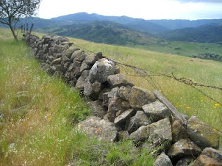
On November 14 I joined a group of friends for a hike from the Monte Bello Open Space Preserve parking lot on Page Mill Road to the Ridge Vineyard about a mile beyond the opposite end of the preserve.


The route can cover from 10.2 to 13 miles, depending on which route you take. We took the longer route, via the White Oak Trail, Canyon Trail, Indian Creek Trail, and Monte Bello Road Trail. You can add on about 9/10 mile by taking the Waterwheel Creek Trail. The award-winning Ridge Vineyard is on Monte Bello Road about a mile beyond (southeast) of the preserve boundary. Our return hike was the most direct way, which is about 5.1 miles.


The vineyard sits atop a ridge with spectacular views of the Santa Clara Valley to the east. There are picnic tables set amid grape vines where we enjoyed our potluck lunch. We bought some wine and some of us tasted wine in the wine tasting room. The vineyard is open Saturdays and Sundays from 11am-4pm.

Saturday, October 29, 2011

Almaden Quicksilver County Park


Today I lead my Foothill College class on a scenic and eventful 5.6-mile ramble through Almaden Quicksilver County Park, south of San Jose. The weather was as perfect as it gets, and we saw acorn woodpeckers, a striped skunk, a tarantula, deer, and several redtail hawks.


Our hike began at the Hacienda entrance on Almaden Road next to the town of New Almaden. We charged uphill on the Mine Hill Trail, then continued on the Randol Trail to the Day Tunnel Trail. From there we headed west on the Great Eastern Trail and then back on the Mine Hill Trail. After a short detour to the Powder House, where the miners used to keep their explosives we continued south on the Mine Hill Trail and on to lunch at the San Cristobal Mine. After exploring a short distance into the mine and watching a tarantula, we continued to the Castillero Trail to an overlook where we examined the Rotary Furnace where cinnabar was heated to release its mercury. After sampling some delicious bay nut brownies I made, we headed north to English Camp and then downhill on the English Camp and Deep Gulch Trail to where we started.


Cinnabar was mined from New Almaden from 1845 until 1972, when the price of mercury plummeted as substitutes were found for this toxic metal. It is the oldest mining area in California, and was the world's second largest producer of mercury. Despite 127 years of intensive mining, and the deforestation and environmental degradation that was the result, this area is remarkably natural. It is amazing how fast human structures fall apart and disappear after they have been abandoned.


After the hike, we stopped at the New Almaden mining museum at Casa Grande in the town of New Almaden. The museum was recently renovated and is worth a visit. It is open Friday through Sunday from 10:00 AM until 4:00 PM.


TO GET THERE... There are four entrances to this park. To reach the Hacienda entrance from Highway 85, take Almaden Expressway south and turn right on Almaden Road through the community of New Almaden. Look for a big parking lot and entrance on the right side of the road.

Saturday, October 15, 2011

Ano Nuevo State Reserve


My Foothill College class enjoyed a pleasant, though mostly overcast day, at Ano Nuevo State Reserve on the southern San Mateo County coast.


Ano Nuevo is famous for its elephant seals, which are the largest members of the seal family. Most people visit from December to March during the mating and pupping season. Male elephant seals arrive in early December to establish breeding hierarchy and are followed in late December by the females, who join the harems of dominant males. From December 15 through March you must be on an organized tour.


This fascinating peninsula is worth visiting all year, and in fact, can be most enjoyable when most of the seals and their hordes of admirers are gone. There are elephant seals at Ano Nuevo nearly all year. In October the juveniles arrive to strengthen their bones by moving around on land for a month or so. We saw several hundred juvenile seals, mostly males, hanging around the beach at North Point. Some of the older juvenile males were engaged in mock combat to prepare for the mating battles to come when they reach maturity.


There is a lot more to see at Ano Nuevo than elephant seals. We also saw California sea lions on the island, two cavorting sea otters, and lots of pelicans and other birds. We stopped at an Indian shell mound to discuss how the native people thrived in this abundant place. We walked about 5.5 miles over mostly level terrain, some it sandy. Then we had lunch at Cove Beach before heading back to the parking lot.


TO GET THERE... the main entrance is on the west side of Highway 1 about 19 miles north of Santa Cruz and about 23 miles south of Half Moon Bay.

Sunday, October 9, 2011

Pescadero Creek County Park


On Saturday, October 8 I lead my College of San Mateo class on an adventurous field trip to Pescadero Creek County Park, deep in the Santa Cruz Mountains. Past field trips to this park took us along the Tarwater Trail Loop through the east side of this park. I thought it was time to explore the west side of the park.


After meeting at Sklyonda (Skyline Boulevard/Highway 84 intersection), we carpooled to our trailhead on Wurr Road, which is between San Mateo County Memorial Park and Pescadero Creek County Park. We then took a loop that included the Old Haul Road, Pomponio Trail, and Shaw Flat Trail, which took us back to the Old Haul Road. We hiked a short distance up a side trail which was too steep. I will leave that one out in the future, though it was a great aerobic workout. We ate lunch at the Shaw Flat Trail Camp, which is one of two trail camps in this park, and one of the few trail camps in the Santa Cruz Mountains that allow camp fires.


This loop, minus the steep side route, is about 5.5 miles. The biggest challenge was crossing Pescadero Creek twice. There are no bridges on this route, and the water level in the creek was higher than expected due to unseasonable rain last week. Some people got wet feet or else took off their shoes and socks to wade across the creek.


Though this park has been heavily logged, we came across some large and ancient redwoods. We also saw a maypole in Worley Flat, lots of banana slugs, and some crawdads in the creek. The consensus was that despite the wet creek crossings this is a worthy field trip destination. In the future I will urge students to bring sandals or water shoes for the creek crossings.


TO GET THERE... From Skyline Boulevard, take La Honda Road (Hwy 84) west. Past the town of La Honda, turn left on Pescadero Road toward San Mateo County Memorial Park. Turn left on Wurr Road and park at the parking lot just beyond the bridge over Pescadero Creek.

Saturday, October 8, 2011

A Butano State Park Ramble


On October 1, 2011 I lead my Foothill/De Anza class on a wonderful 5.12-mile loop hike at Butano State Park in the Santa Cruz Mountains. It is hard to overstate the charm of this cool, green canyon park. Because of its location on the west side of the range, far from population centers, Butano is one of the most remote parks in the Bay Area.


Our hike began on the park road, which becomes a dirt road past the gate. We then turned uphill on the Goat Hill Trail and then headed east on the Doe Ridge Trail. Just east of where this trail intersects the Olmo Fire Road we stopped for lunch on the ridge top where we enjoyed views into the Little Butano Creek Canyon and the Gazos Creek Canyon. We examined the dense cones of the Knobcone Pines that grow atop the ridge.


Many banana slugs, some mating, were seen that day.


TO GET THERE... from Highway 1 in southern San Mateo County, take Pescadero Road or Gazos Creek Road to Cloverdale Road. The park is about 5 miles south of Pescadero. There is a parking fee.

Thursday, June 23, 2011

The Berry Creek Falls Loop


The 11.5-mile loop hike from Big Basin Redwoods State Park headquarters to Berry Creek, Silver, and Golden Falls is considered by many to be the best hike in the Bay Area. Take an entire day and enjoy the waterfalls and remote old-growth redwood groves, stopping often to appreciate the wonderful variety of scenery. Big Basin has the best display of large redwood trees in the Bay Area, far superior to the more famous Muir Woods.


I usually do this hike in late March or early April, when the falls are at their peak. This year, however, I hiked the Skyline-to-the Sea Trail/Berry Creek Trail/Sunset Trail loop on June 21, the longest day of the year. Because of unusual heavy rain on June 2 and 4, the falls are still going strong. Because the temperature was in the 80's we cooled off under Silver and Golden Falls. Access to Berry Creek Falls is restricted to protect vegetation. I hiked with my friend Keith and his kids, Steven and Mariah.


If you have some extra energy, take the .6-mile Redwood Trail loop near park headquarters. It will take you to some of the biggest trees in the park, including The Father of the Forest, which is probably the biggest tree in the Bay Area.


TO GET THERE... from Skyline Boulevard take Highway 9 southwest and turn west on Highway 236 at Waterman Gap or at Boulder Creek. The hike begins at the "Redwood Trail" sign next to the parking lot.

Saturday, May 21, 2011

portola Valley Trails


Portola Valley is an affluent community with a wonderful trail system that combines residential and wild land areas. On and near the San Andreas Fault, this land is a pleasant patchwork of woodlands and grassy meadows. It is particularly enticing in the Spring when the grasses are green and the wildflowers are in bloom. This land is forested mainly with oak, madrone, and bay.


On Saturday, May 21, I lead my CSM class on a field trip that started at the parking lot along Alpine Road at the intersection of Willowbrook. We combined the Old Spanish Trail with the Toyon Trail. We stopped for lunch at the large sag pond, on a main fracture of the San Andreas Fault, at the intersection of the Old Spanish Trail and the Lake Trail. Because of the cool, moist Spring, we saw many wildflowers, including columbine, flax, blue dick, globe lilly, winecup clarkia, and one beautiful spotted coral root orchid (see photo). Our route covered about 5.5 miles.


TO GET THERE... From Highway 280 take Alpine Road south and park near its intersection with Willowbrook Drive.

Sunday, May 8, 2011

Early May on Russian Ridge


I hiked twice in the past week in Russian Ridge Open Space Preserve. The first two weeks of May is the perfect time to visit this ridge top preserve because of the extraordinary abundance of wildflowers. On Monday, May 2 I hiked with some friends on a warm and sunny day. The next Saturday, May 7, the weather had turned cool and foggy for my College of San Mateo field trip. On my May 2 hike we saw a long-tailed weasel running through the grass (see attached photo).


From the parking lot on Alpine Road just west of Skyline Boulevard you can take a scenic 4.8-mile loop by combining the Ridge Trail, Hawk Trail, and Ancient Oaks Trail. This route combines spectacular views (on a clear day) with oak woodlands. Be sure to ascend Borel Hill, the highest point in San Mateo County, for the view. You can expand this route by entering Coal Creek, Skyline Ridge, and Monte Bello Open Space Preserves.


TO GET THERE... from Skyline Boulevard park at the parking lot at the intersection of Skyline and Alpine Road. You can also park at the vista point along Skyline Boulevard about 1.5 miles north of Alpine Road.

Sunday, May 1, 2011

Pescadero Creek County Park


Pescadero Creek County Park has so many hiking opportunities it is necessary to make numerous excursions to really get to know this park. The park itself covers 6,486 acres of forest and mountains. You can also take trails into adjacent Sam McDonald County Park, San Mateo County Memorial Park, and Portola State Park. There is also a trail that links this park to Big Basin State Park.


On Saturday, April 30 I lead my Foothill-De Anza College class on a 4.8-mile outing from the Tarwater Trailhead on Camp Pomponio Road. We headed downhill on the Tarwater Trail, pausing at a huge old fire-scarred redwood, and then continued to the remains of the Moore, Fisher, & Troupe lumber mill, built in 1915, where we examined an iron boiler that was left behind. We then checked out the Tarwater Trail Camp and then enjoyed a leisurely lunch on the banks of Pescadero Creek. After lunch we continued on the Tarwater Trail Loop and stopped to see where tar is seeping out of the earth in Tarwater Creek. We also stopped at the site of a pioneer homestead, where one building and a row of pear trees remain. We saw lots of beautiful Douglas iris and mule ear flowers along the way.


TO GET THERE...From Highway 280 take Page Mill Road west (uphill) to Skyline Boulevard, where it turns into Alpine Road. Continue on Alpine Road and turn left (south) on Camp Pomponio Road, which takes you to the trail head parking lot. To find Camp Pomponio Road look for a sign to the County Correctional Facility and to Pescadero Creek County Park.

Sunday, April 24, 2011

A Spring Hike at Santa Teresa County Park


Santa Teresa County Park, in southern San Jose, is a great place for an April hike. I took my College of San Mateo Peninsula Parks & Trails class there on Saturday, April 23. We met at the Pueblo Group Picnic Area and then walked a 4.5-mile loop that included Hidden Springs Trail, Ridge Trail, Coyote Peak Trail, the Coyote Peak Loop, the Rocky Ridge Trail, and the Mine Trail. We ate lunch and enjoyed beautiful views from atop Coyote Peak. The trail up to Coyote Peak is quite steep in places.


The Rocky Ridge Trail follows a serpentine outcropping with beautiful wildflowers that are adapted to growing in the inhospitable serpenitine soil. Associated with earthquake faults, serpentine is high in magnesium and low in nitrogen and phosphates, which inhibits the growth of most plants, including the non-native grasses that dominate most of the open fields in the Bay Area. By stunting the growth of these non-natives, serpentine allows native wildflowers such as goldfield, poppies, creamcups, and linanthus to thrive.


Santa Teresa County Park has more than 14 miles of trails for hikers, equestrians, and bicyclists. Leashed dogs are allowed on the trails. It has group picnicking, a field archery range, and an eighteen-hole golf course.


TO GET THERE... from Highway 85 or 101 take Bernal Road exit and head west.

Friday, April 22, 2011

Calero County Park


April is the perfect month to explore Calero County Park. On the dry, east side, of the Santa Cruz Mountains, this steep and rugged park becomes hot and dry by the middle of May.


On Saturday, April 16 I lead my Foothill-De Anza class on a 5.8-mile ramble through Calero, with lots of great views, wildflowers, gnarled old oaks, a flock of wild turkeys and a coyote. From the main entrance off McKean Road, we we hiked up the Los Cerritos Trail to the Pena Trail and then walked a figure-8 route that combined the Javalina Loop Trail with the Figueroa and Vallecito Trails. We enjoyed sweeping views of the Calero Reservoir to the north, the Santa Clara Valley to the east, and Mount Umunhum and Loma Prieta to the west.


TO GET THERE...from Highway 101, south of San Jose, take Bailey Avenue west, and McKean Road south to the park entrance.